

Introduction
The accelerated advancement of digitization is impacting many industries. Increasingly complex global supply chains have revealed that companies are turning to real-time tracking solutions in order to ensure transparency throughout their entire chain of processes. The variety of components is diverse, and ultra-precise management of assets is a fundamental challenge that companies are continually trying to solve. Before committing to a real-time tracking solution, organizations must holistically define their requirements in order to find the right approach.
A wide spectrum of locating technologies is readily available on the market, with an abundance of vendors offering locating solutions. Each technology has unique characteristics and applications for specific use cases. Having a plethora of different technologies and vendors from which to choose is a step in the right direction. However, customers in industries that capitalize on locating technologies are faced with solutions that are proprietary and inflexible, creating silos and fragmentation in the market.
The ability to create zones and fences for asset tracking is not revolutionary. However, the ability to seamlessly integrate locating technologies from different vendors and providers is a unique strength of the new omlox standard. The DeepHub® is the premier omlox-compliant middleware that enables the management and full visibility of all location data in a single platform, eliminating the need for cumbersome and complex setups.
As we have recently released the latest version of the DeepHub – 2021 R1, 1.2.0, we would like to use this opportunity to dive deeper into some of the core features and functionalities of the DeepHub that form the foundation of this new, industry-shaping technology.
Intuitive, Real-Time User Interface
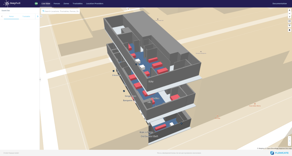
The DeepHub user interface is a web application that allows for the real-time display and management of location data. It was designed with user-friendliness and intuitiveness at the forefront – so users spend less time figuring things out, and more time managing their data.
The user interface provides several quality of life features, including:
- A global background map that may be switched between satellite imagery and vector data
- A search bar for quick and easy searching of zones, fences, trackables, locations, and points of interest
- Support for several methods of creating zones and fences, depending on the user’s needs
- A network connection indicator
- A user experience that is immediately familiar to anyone with experience working with web maps and GIS applications
The user interface consists of four key system components:
Live View
Live View fetches the event triggers when a trackable¹ is detected in a zone² or fence³. An event is triggered when a trackable enters a fence, as well as when a trackable exits a fence, and this is displayed in real-time on the map. Additionally, a timestamp is displayed in the left side pane within the user interface.
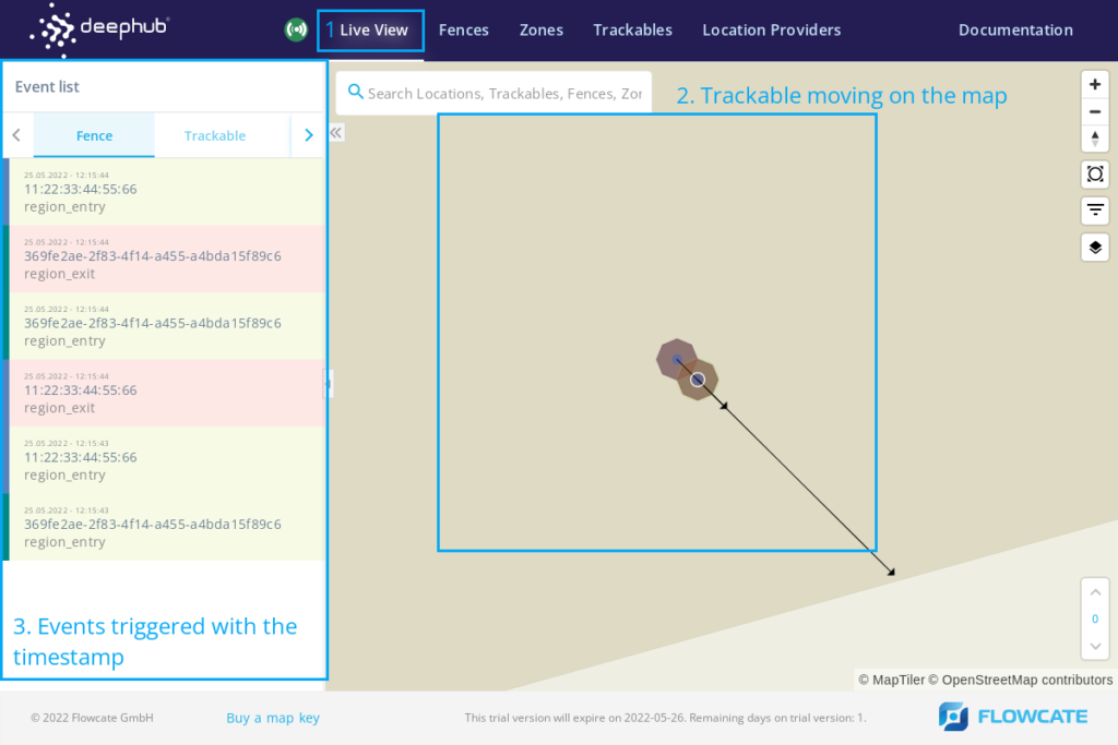
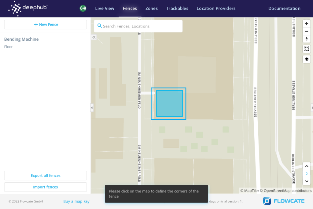
Fences
This component allows users to create and manage geo-fences. Trackables entering and exiting fences trigger fence events. Fences can be created independently of zones – and thus independent of a specific location technology and it’s zone-local coordinate system.
As fences may be given an extrusion, this allows for the creation of fences representing highly-granular areas, such as a specific shelf of a rack in a warehouse or distribution centre.
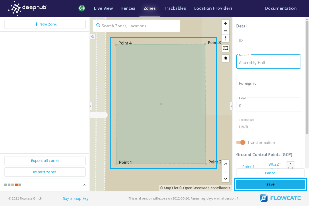
Zones
This component is used to define the localization zones on the map for multiple positioning technologies, such as Wi-Fi, UWB, RFID, and BLE. The main purpose of a zone is to handle the transformation between zone-local coordinates systems and global coordinates. Upon completion of installation and implementation of localization infrastructure at a facility, zones would need to be set up in the DeepHub based on localization techniques.
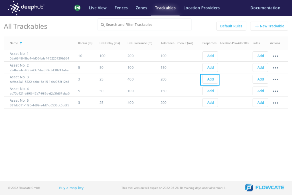
Trackables
This component allows users to assign trackables to assets being tracked, and attach the associated positioning providers. Trackable parameters such as radius, exit delay, and collision tolerance can be defined as per requirements. Additionally, custom properties such as information about the asset can be defined.
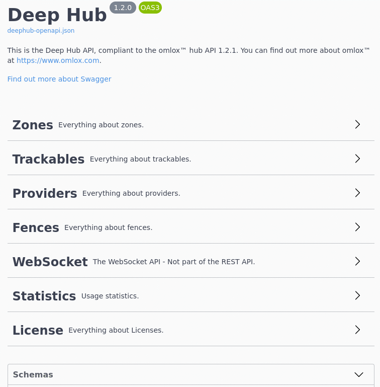
Standardized APIs
REST API
The brain of the DeepHub resides with the DeepHub API. Anything that can be done through the DeepHub User Interface can also be done through the DeepHub’s central REST API. However, the API allows for a greater degree of control and flexibility.
The DeepHub API is compliant with the omlox hub API. It was designed and modeled based on version 3 of the OpenAPI Specification (OAS3), the industry standard for RESTful APIs. Because of this, the DeepHub API will feel familiar and easy-to-use for developers, teams, and organizations alike.
WebSocket API
Using the WebSocket API, users can easily publish or subscribe to topics by establishing a connection and exchanging messages and events over a WebSocket connection between application(s) and the DeepHub. Users can subscribe to location updates, fence events, collision events, and the movement of trackables.
The API also allows for data filtering and the ability to add parameters to requests that can transform the data. For example, a user may subscribe to the movement of a specific trackable and request for the coordinates in the response to be provided in a specific coordinate reference system.
Event Generation
A previously mentioned, the DeepHub allows users to easily create fences that trigger geo-fence events. A fence event occurs when a trackable and/or location provider enters and exits a fence, and a timestamp is generated for both entry and exit events. This alone provides a plethora of use case applications, such as asset tracking and tracing, reducing search times for assets, analytics, shop floor security, job scheduling, etc.
The DeepHub also provides information on the movement of trackables and can generate collision events. A collision event occurs when two trackables collide, and a timestamp is generated for the start and end time of the collision. Similarly, these events enable several use cases, such as social distancing, collision control, AGV navigation and management, etc.
Dynamic & Flexible Mapping
Flexibility is at the core of the DeepHub; users are seamlessly able to switch the background map provider that is displayed in the DeepHub user interface to cater to their specific requirements. The DeepHub supports Mapbox and MapTiler, allowing users to display their own custom-made web maps. Alternatively, our team of GIS Specialists can produce web maps in Mapbox and/or MapTiler that are 3D and span multiple buildings and floors.
Seamless Vendor & Technology Integration
The DeepHub addresses a fundamental challenge that organizations face with industrial applications and solutions, wherein they are often locked-in with specific vendors and their proprietary products. As the premier omlox-compliant middleware, the DeepHub can integrate any locating technology from any vendor. This opens the door for a multitude of new use cases, while lowering total cost of ownership.
Conclusion
The DeepHub was officially released a few months ago, and organizations are continually engaging with us to explore partnership opportunities and joint offerings. The sky is the limit – we will continue to strategically and meticulously enhance and refine the product based on feedback from our partners and industry requirements.
We hope you found this overview of the DeepHub informative and helpful. Please do not hesitate to contact us for more information!
Endnotes
- A trackable refers to an object or person in the real world, such as an e-ink display, an AGV, a drone, a worker with a smartwatch, etc. A trackable object can comprise several location providers (like UWB, WiFi, BLE, GPS, etc.), where each of the providers causes an update of the trackable location. A trackable may also have a shape.
- A zone describes an area of transformation that applies to RTLS (e.g. UWB, WiFi), proximity-based locating systems (e.g. RFID, BLE), as well as custom areas of measurement (e.g. for setting up a utility zone to measure locations using a laser distance meter and transforming locations to GPS coordinates). It is the common denominator between different locating technologies and thereby enables for processing location data according to the configured type of the zone and common meta information – in a standardized way.
- A geofence defines a polygonal or circular boundary within an area for geofencing events, anywhere on the globe using “real world” (geographic) coordinates. A geofence polygon may contain holes.
Comments are closed.